


-
(river in korea)
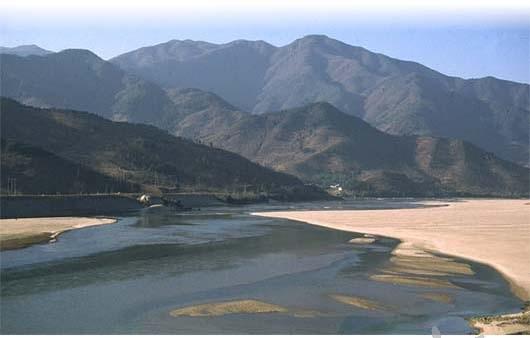
The Somjin River is Korea's ninth longest river, and stretches 212.3 km from the remote mountains of North Cholla Province to Kwangyang Bay on the south coast. The river is famous for its fine sandy banks, hence its nicknames: Sand River and River with Abundant Sands. It is relatively narrow and has many exposed rocks along its banks.
Kwangyang Ba
The Chinese character Som means toad. The name derives from a local legend. In 1385, invading Japanese pirates were ambushed by hundreds of thousands of croaking toads and fled in the direction of Kwangyang on the south coast.
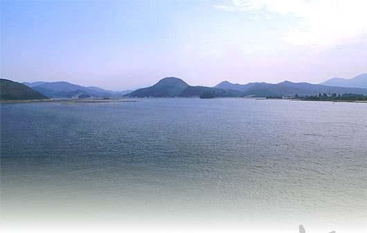
In 1965, a multi-purpose dam was constructed to provide electricity and irrigation to the surrounding area, including a reclaimed area at Kyehwado. A massive steel mill has been constructed and is now operating in Kwangyang.
The River's Source
The Somjin River originates on Mt. Moak on the border between Kimje and Wanju counties in North Cholla Province. It is part of the Noryong Range and borders on the Honam Plain, an important rice-producing region. The mountain is famous for its natural beauty and is home to numerous cultural properties and several major Buddhist temples including Taewon, Suwang, Shimwon, and Chongyon temples.
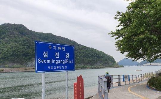
섬진강(蟾津江)은 우리나라에서 9번째로 긴 강으로 전라북도 산간벽지에서 남해안 광양만까지 212.3km에 이른다. 강은 고운 모래사장으로 유명하여 모래 강, 모래가 풍부한 강이라는 별명을 가지고 있다. 비교적 좁고 둑을 따라 노출된 바위가 많이 있다.
광양만
한자 섬(蟾)은 두꺼비를 뜻한다. 이름은 지역 전설에서 유래되었다. 1385년 일본을 침략한 해적들은 수십만 마리의 두꺼비에게 습격당하고 남해안 광양 방면으로 도망쳤다.
1965년 계화도 매립지를 비롯한 주변 지역에 전기와 관개를 제공하기 위해 다목적댐이 건설됐다. 거대한 제철소가 건설되어 현재 광양에서 가동되고 있다.
강의 근원
섬진강은 전라북도 김제군과 완주군 경계의 모악산에서 발원한다. 노령산맥의 일부로 중요한 쌀 산지인 호남평야와 접해 있다. 이 산은 자연미로 유명하며 수많은 문화재와 태원사, 수왕사, 심원사, 총연사 등 여러 주요 사찰이 있다.
(참고)
금남호남정맥의 산줄기인 팔공산 북서쪽의 '천상데미(하늘에 오르는 봉우리)' 서쪽 기슭, 진안군 백운면 원신암마을 북쪽계곡 상추막이골에 섬진강 발원샘인 '데미샘'이 있다. 이 데미샘에서 부터 흘러가는 섬진강은 호남 지방의 옥토를 가꾸는 젖줄이다.
위 URL을 길게 누르면 복사하실 수 있습니다.

 위로
위로